CENTRAL TEXAS REGIONAL ASOCC
The Clean Energy Tech Center will provide the SH130 ASOCC

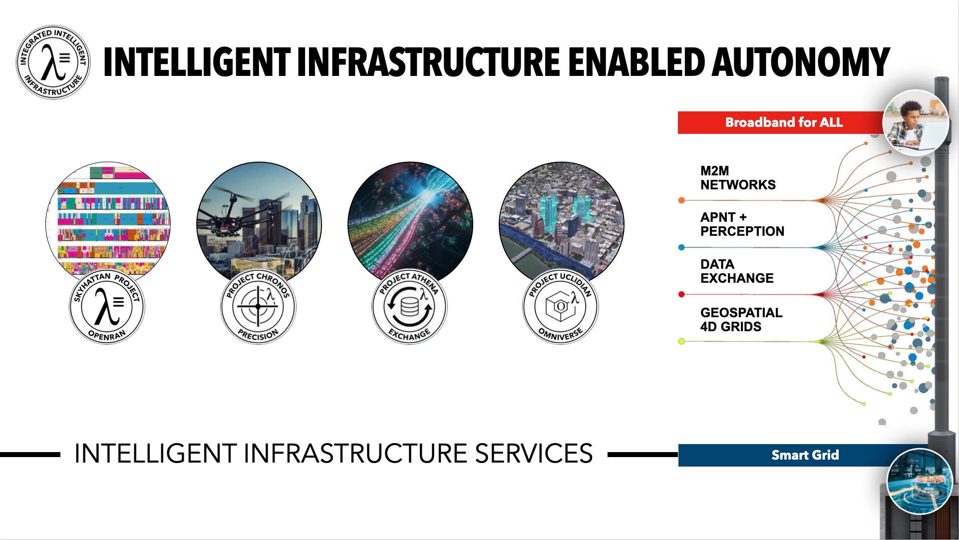
INTELLIGENT INFRASTRUCTURE CORRIDOR
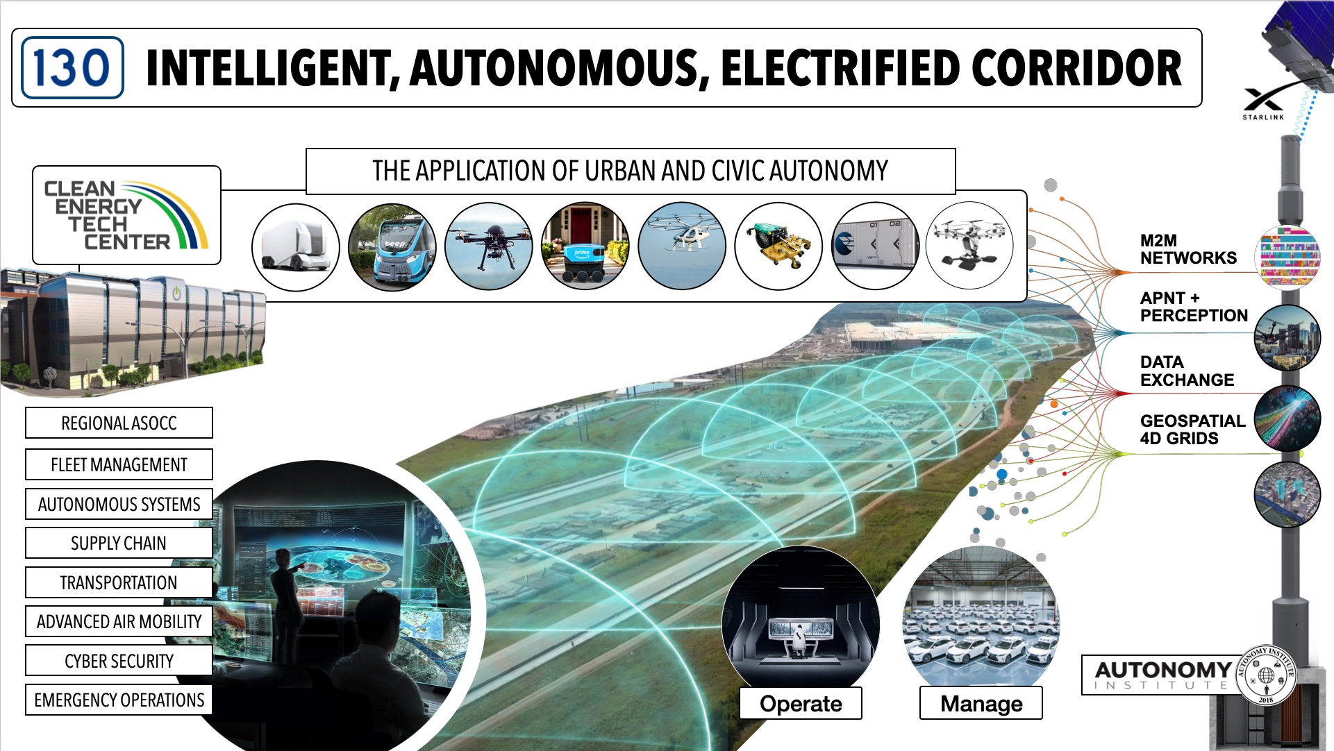
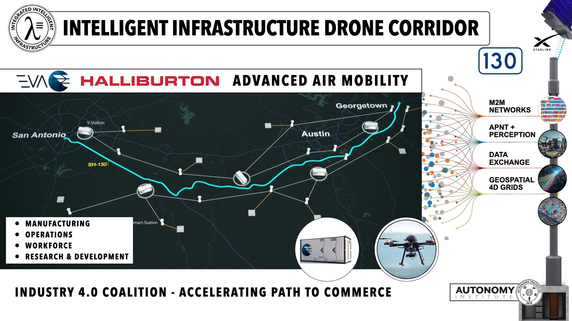
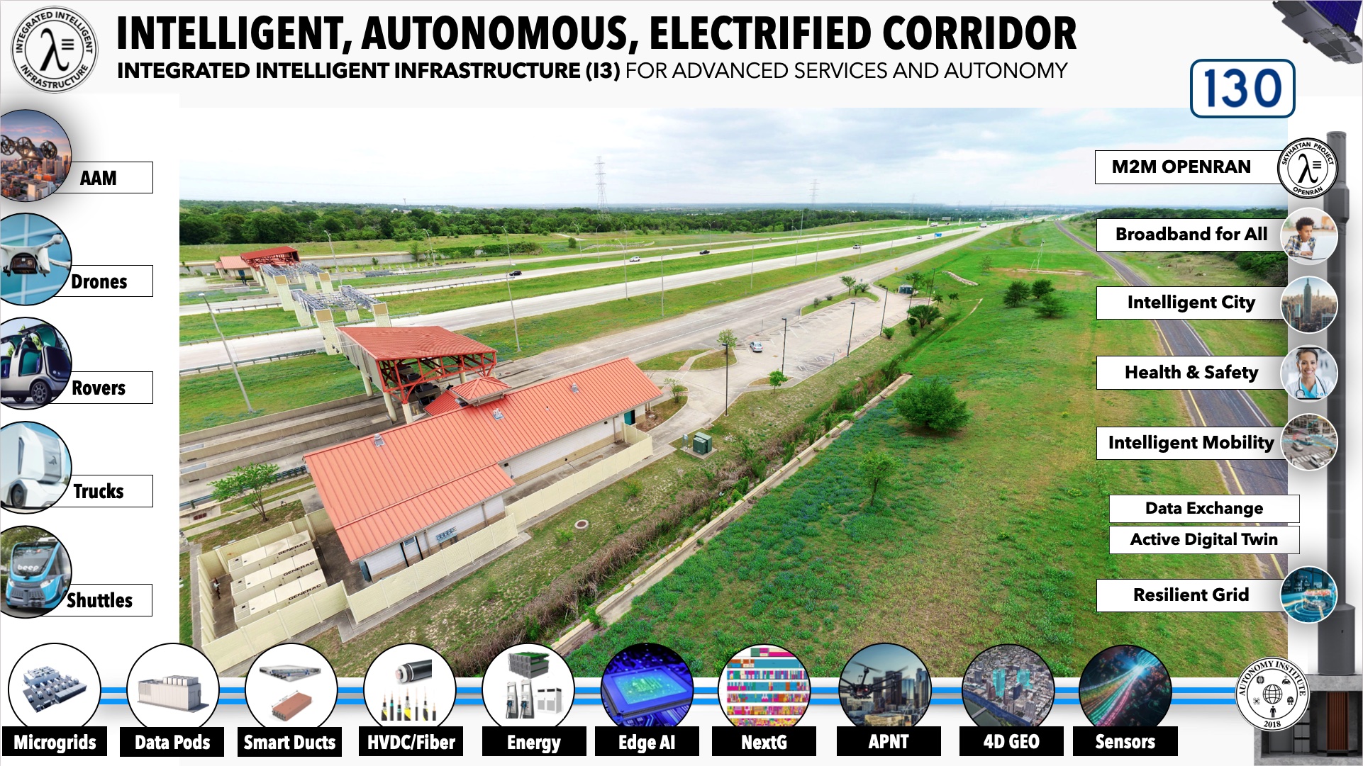
The SH130 Region will be one of the first Intelligent, Autonomous, and Electrified Corridors in the Nation. The Autonomy Institute is collaborating with operating partners, Texas cities and agencies on a regional deployment of Intelligent Infrastructure.
Several commercial developers with properties along the SH130 corridor are providing leadership and collaboration to accelerate deployments. This corridor will activate broadband, advanced wireless, connected systems sensors, assured position-navigation-timing, charging infrastructure, edge computing, and other devices. All to support near-term and long-term services to our communities.
The leadership of the Clean Energy Tech Center (CETC) is providing the critical facilities to enable these advanced services. The CETC facility will also support the nation’s first ASOCC, supporting operations from several industries in a safe, secure, and collaborative environment. This intelligent corridor will support automated freight and delivery; intelligent and autonomous vehicles; and advanced services to communities along the corridor. This Intelligent Infrastructure will eliminate the digital divide and accelerate Texas into the 21st century with jobs, economic growth, and stronger more resilient communities.
The Transportation industry will drive the deployment of the Intelligent Infrastructure that will enable Industry 4.0. Unleashing the largest productivity boom in world history and securing our national sovereignty.
“Investment in a 21st-century Intelligent Infrastructure is among the highest priorities for stimulating economic expansion, national security, and job growth.”
Intelligent Infrastructure Delivers:
-
VISION ZERO
-
BROADBAND ALL
-
OPTIMIZED MOBILITY
-
HEALTH & SAFETY
-
INTELLIGENT CITY
-
RESILIENT GRID
-
AUTOMATE SYSTEMS

Each Intelligent Corridor will activate PINN clusters to support edge computing, NextG, Broadband, and charging stations within regions that have been previously isolated or disconnected. The deployment will support near-term and long-term services to our communities. The SH130 Coalition is developing an integrated deployment plan for the entire 92-mile stretch the highway. The PINNs will support include broadband, advanced wireless, connected systems sensors, assured position-navigation-timing, charging infrastructure, edge computing, etc.
INTELLIGENT INFRASTRUCTURE
Project Omniverse
Active Digital Twins can improve planning activities such as public engagement, scenario planning, and zoning and development. They have the potential to assist planners in reaching local climate resilience, economic development, and housing goals (just to name a few).
The digital twin helps foster collaboration between planning organizations and other city departments and agencies. The Digital Twin is the foundation for city planning, modeling of physical infrastructure, environmental indicators, resource consumption, zoning & regulation, transportation planning, and watershed management. The Digital Twin will require a data exchange with standardized data formats and that support cross-departmental experimentation.
Project Skyhattan
The worlds first RAN network built from the ground up for Machine-to-Machine and Autonomous Systems. Wireless Manhattan Project for ground and low altitude airspace.
Services like Artificial Intelligence, Intelligent Transportation, and Autonomous Systems will require an entirely new network to support any scaled adoption. Edge computing, low-latency wireless, and new spectrum are key. This will be driven by new enabling technologies and standards like OpenRAN, Edge Computing, SDN, and Resilient PINNs. Just as the Internet flattened the proprietary wired network, this new OpenRAN will flatten the wireless networks.
PINN Clusters will lead the creation of the nation’s first Data-As-a-Utility.
Project Chronos
Providing precise positioning and perception will allow support for more advanced Operational Design Domains (ODD) and accelerate additional use cases. A terrestrial enhanced GPS has become a national priority and will be funding by government and private infrastructure investors.
VOICES, CARMA, DRF, OPENRAN
Project AIRE
Each Intelligent Corridor will activate PINN clusters to support edge computing, NextG, Broadband, and charging stations within regions that have been previously isolated or disconnected. The deployment will support near-term and long-term services to our communities. The SH130 Coalition is developing an integrated deployment plan for the entire 92-mile stretch the highway. The PINNs will support include broadband, advanced wireless, connected systems sensors, assured position-navigation-timing, charging infrastructure, edge computing, etc.
Project ATHENA
Intelligent cities will depend on the creation of “Data-Exchanges”, a sovereignty database of all the information collected by the city IoT systems and sensors. The Data-Exchange will allow secure, private, and transaction sharing of valuable data assets with trusted and approved partners. Data Exchanges will not only support more efficient operations it can become a new economic platform for the city.
Project COMMERCE
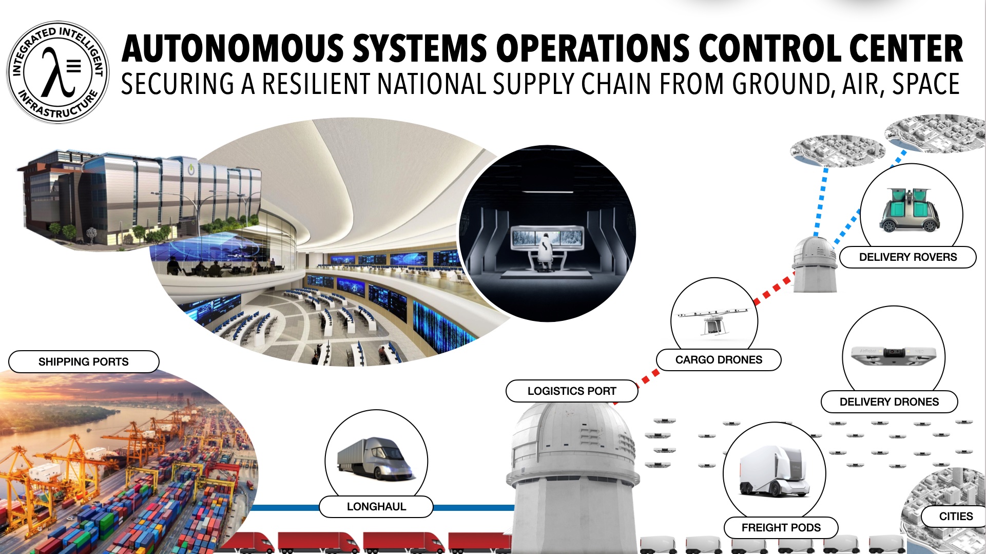
Autonomous Systems Operational Control Centers (ASOCC) will support persistent operations to provide safe, secure, and collaborative public and private deployments of the Intelligent Infrastructure that will enable Industry 4.0 systems. As we embrace more advanced systems within cities and states there has to be a unified Active Digital Twin from the power grid up.
Regional ASOCCs would include:
-
Integrated Transportation
-
Teleoperations
-
Cyber Security Operations
-
Autonomous Systems
-
Emergency Operations
-
Advanced Air Mobility
-
Supply Chain Logistics
-
Electrical Grid Resilience
LEADING DEPLOYMENT PARTNERS
This includes compute, network, wireless, fiber, engineering, electric, cloud, intelligent transportation, micro weather, data exchanges, and many others.


OPERATIONAL SYSTEMS AND PROVIDERS
The activation of the Intelligent Infrastructure and a deployed ASOCC will all the collaborative approach required for a Path to Commerce.
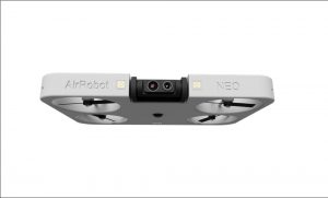
Inspection Drones
AIRE PlatformResilient Infrastructure
Inspection Drones

Medical Drone
AIRE PlatformSupply Chain
Delivery for Emergency MedicalDistribution Drone
AIRE PlatformSupply Chain
Resilient Supply Chain Logistics
Freight Drone
AIRE PlatformSupply Chain
Reducing Emissions, Traffic, and Optimizing Logistics

Personal Rover
AIRE PlatformDelivery Services
Personalized Delivery

Delivery Rover
AIRE PlatformDelivery Services
Community Delivery

Freight PODs
AIRE PlatformSupply Chain
Resilient Supply Chain Logistics

Freight Truck
AIRE PlatformSupply Chain
Resilient Supply Chain Logistics
Fire Fighting
AIRE PlatformPublic Safety
Responsive Public Safety

Public Safety
AIRE PlatformPublic Safety
Responsive Public Safety

Safety Vehicles
AIRE PlatformPublic Safety
Responsive Public Safety

Safety Patrols
AIRE PlatformPublic Safety
Responsive Public Safety

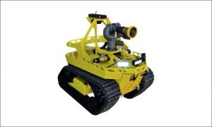
AG Robotics
AIRE PlatformAgriculture
Autonomous Agriculture

Maintenance
AIRE PlatformEnvironment
Autonomous Grounds Maintenance
AG Tractor
AIRE PlatformAutonomous Agriculture
Autonomous Agriculture

Earth Moving
AIRE PlatformAutonomous Construction
Autonomous Construction

Excavation
AIRE PlatformAutonomous Construction
Autonomous Construction

Shuttles
AIRE PlatformMobility 4.0
Mobility for All, Reducing Congestion and Emissions.

Vehicles
AIRE PlatformMobility 4.0
Mobility for All, Reducing Congestion and Emissions.

Electric Buses
AIRE PlatformMobility 4.0
Mobility for All, Reducing Congestion and Emissions.